

Map 2026
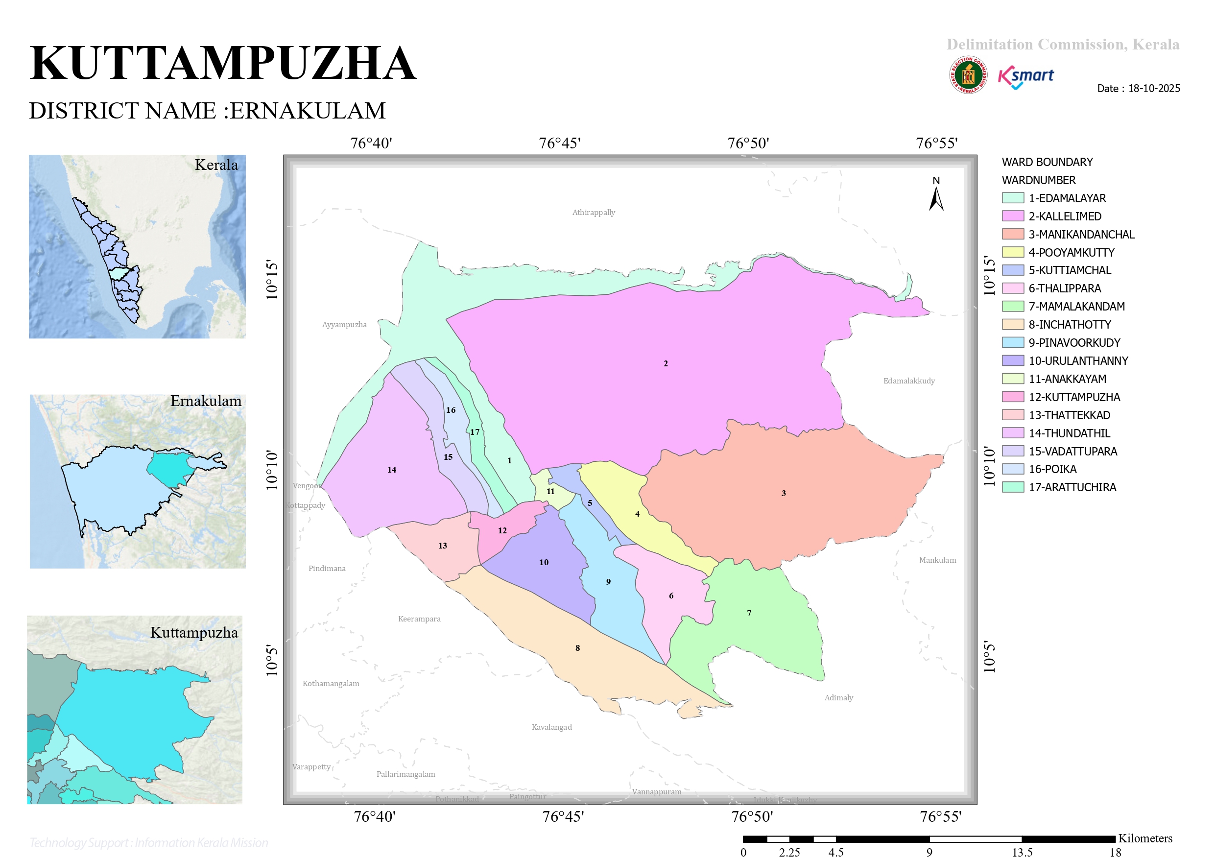
Kuttampuzha Grama Panchayat: Basic Information
Located in the Kothamangalam Taluk of Ernakulam district, Kuttampuzha is one of the largest Grama Panchayats in the region, richly endowed with lush forest areas.
Borders
Bounded by extensive forest lands and rivers, the borders of Kuttampuzha Panchayat are as follows:
North: Parts of Thrissur district (Athirappilly region) and Adimali Panchayat in Idukki district.
East: Devikulam Taluk of Idukki district (including the forest areas of Edamalakudy) and the border of Tamil Nadu state.
South: Keerampara, Kottappady, and Vengoor Panchayats.
West: Kavalangad Panchayat and parts of the Munnar Wildlife Sanctuary.
Population
According to the 2011 Census data, the demographic details are as follows:
| Category | Statistics |
|---|---|
| Total Population | 24,799 |
| Males | 12,554 |
| Females | 12,245 |
| Total Households | 6,487 |
| Literacy Rate | 89.38% |
Special Note: A significant population of Scheduled Tribes (indigenous tribal communities) resides in Kuttampuzha Panchayat. Tribal communities constitute approximately 17.2% of the total population.
Wards
Kuttampuzha Grama Panchayat is divided into 17 wards. They are:
Edamalayar
Kallelimed
Manikandanchal
Pooyamkutty
Kuttiamchal
Thalippara
Mamalakandam
Pinavoorkudy
Inchathotty
Urulanthanny
Anakkayam
Kuttampuzha
Thattekkad
Thundathil
Vadattupara
Poika
Arattuchira
Surrounded by the Edamalayar Dam and the Kuttampuzha River (a tributary of the Periyar River), this region is highly renowned for its natural beauty and prominent tourist attractions, such as the Thattekkad Bird Sanctuary.